UTAH
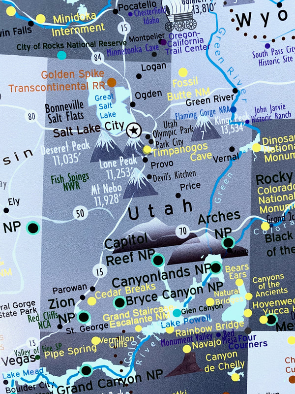
UT Points of Interest:
- Arches NP
- Canyonlands NP (Mesa Arch, Shafer Trail, Potash Rd, White Rim Trail)
- Bryce Canyon NP
- Zion NP (Narrows, Angels Landing)
- Capitol Reef NP
- Dead Horse Point SP
- Goblin Valley SP
- Coral Pink Sand Dunes SP (10mi west of Kanab)
- Grand Staircase-Escalante NM (Hole in the Rock Rd, Burr Trail, Golden Cathedral)
- Bears Ears NM
- Natural Bridges NM
- Vermillion Cliffs NM
- Glen Canyon, Lake Powell
- Bonneville Salt Flats
- Highest peak: King's Peak (13,534ft)
- Highest road:
- Scenic routes: UT-128, UT-12, UT-89, UT-89A, UT-95 (Hite),
- National forests: Dixie, Fishlake, Ashley, Uinta-Wasatch,
- Cities: Moab, Escalante, Boulder, Monticello, Hite, Kanab, Panguitch, St. George, SLC, Provo
- GPX files
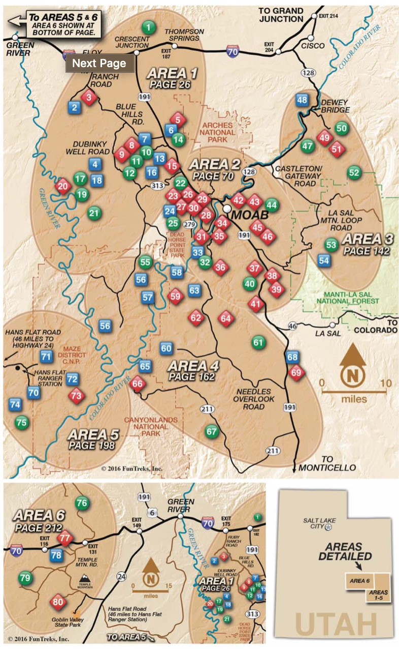
- Moab area BLM maps
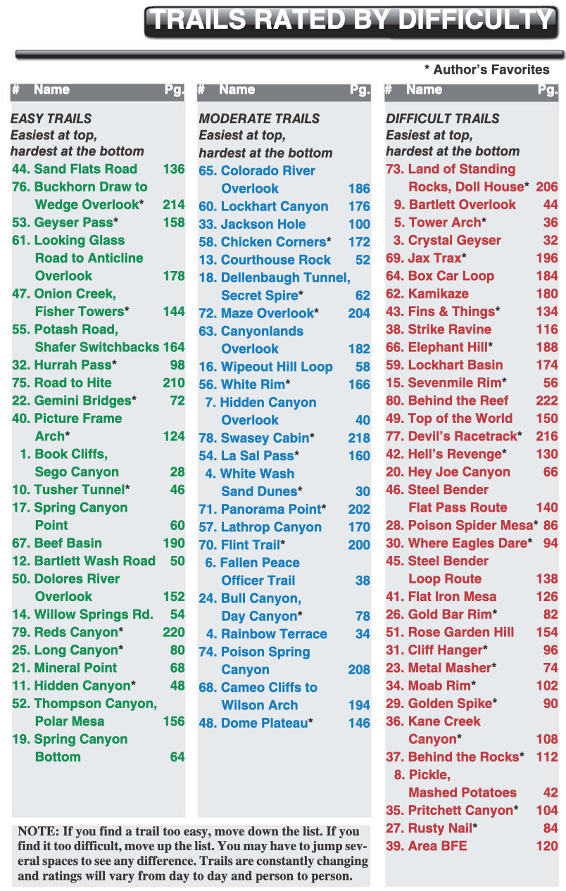
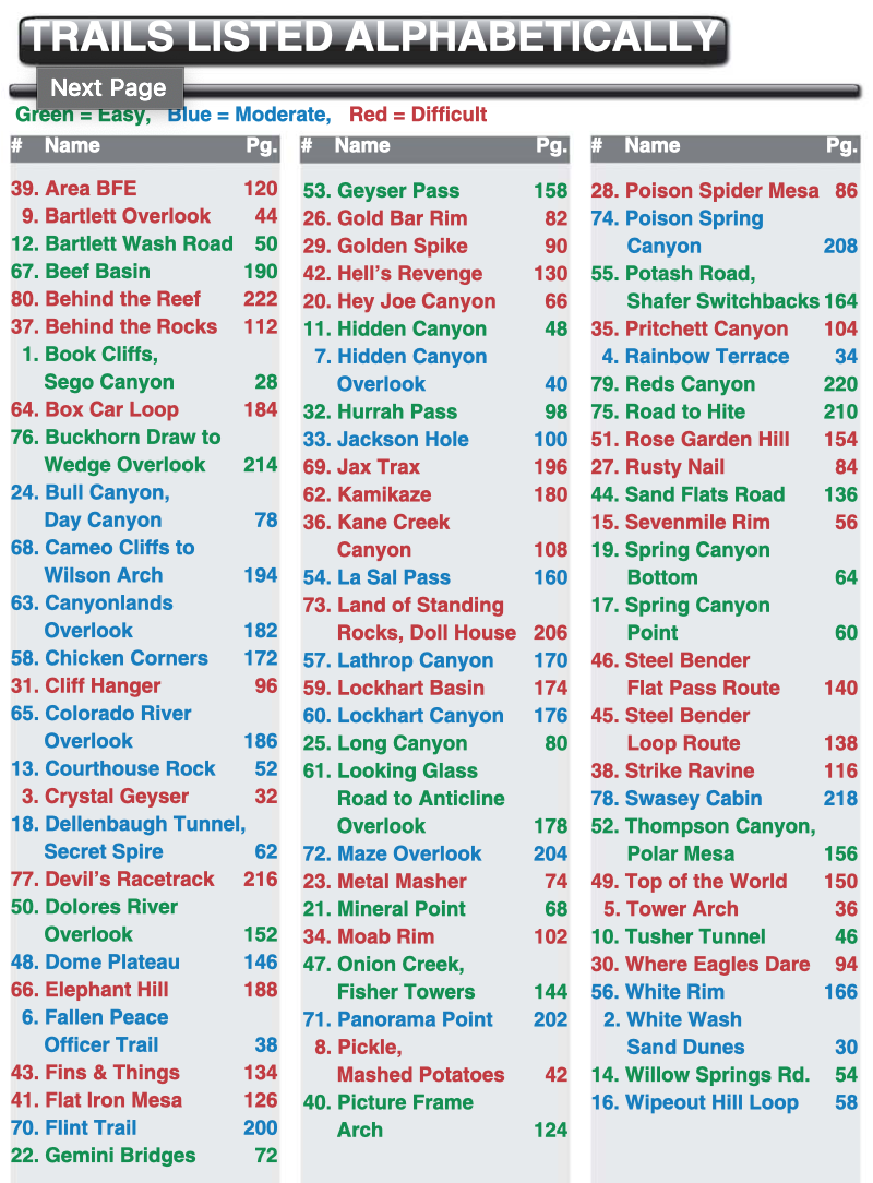
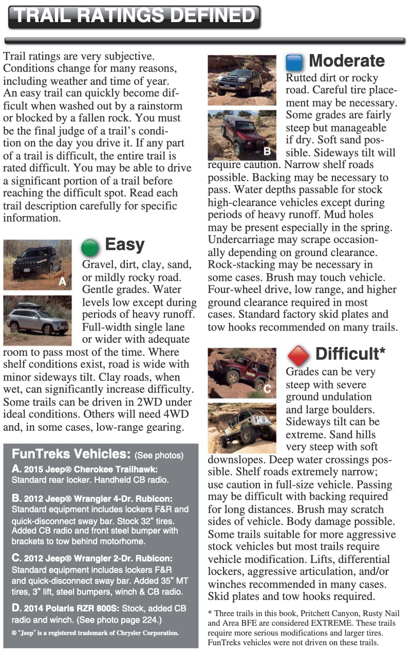
The following are from Amazon's page of the excellent FunTreks book:
Moab area trails completed by SoloOverland (as of July 2020):
EASY:
- Sand Flats Road (44) ✔︎
- Gemini Bridges (22) ✔︎
- Long Canyon (25) ✔︎
- Hurrah Pass (32) ✔︎
- Onion Creek / Fisher Towers (47) ✔︎
- Potash Road / Shafer Trail (55) ✔︎
- Hole in the Rock Road ✔︎
- Burr Trail ✔︎
- Cottonwood Canyon Road ✔︎
- La Sal Moutain Loop Road ✔︎
- Dolores River Overlook (50)
- Thompson Canyon / Polar Mesa (52)
- Geyser Pass (53)
- Road to Hite (75)
MODERATE
- Chicken Corners (58) ✔︎
- Colorado River Overlook (65)
- Lockhart Canyon (60)
- Jackson Hole (33)
- La Sal Pass (54)
- White Rim (56)
- Flint Trail (70)
- Panorama point (71)
- Maze Overlook (72)
- Poison Spring Canyon (74)
DIFFICULT
- Fins and Things (73)
- Elephant Hill (43)
- Top of the World (49)
- Hell's Revenge (42)
